| Sign In | Join Free | My burrillandco.com |
|
... such as SD card, USB pen drive, mini-B interface This kind of Hi-Target high precision total station is widely used in surveying and mapping,engineering construction,it's popular in the market for it's high...
GNSS GPS Survey Equipment Land Surveying Instrument GPS Land Meter Measuring Land Area Distance Tools Slope Measurement: . At the Slope in parameter setting, press the [▲/▼] button to ......
Real Time Map GPS Land Measuring Instrument Outdoor Survey Instrument Land Area Meter Main Features and Benefits: It measures the length, width and area of the farm through satellites, and also has the function...
...Accuracy Water Level Gauge For Liquid Water Tank Water Well Level Sensor Meter Product Description The Steel Ruler Water Level Gauge by Henan Rancheng Machinery Co., Ltd. is a precision instrument designed f...
48 Channel Seismic Survey Equipment Seismic Refraction Equipment What equipment is used in seismic survey? WZG-48C Seismic Survey Equipment WZG-24C Seismic Survey Equipment WZG-12C Seismic Survey Equipment WZG-...
...level for Geodetic & Land Survey The ZTS-320/R is configured with advanced dual-axis compensatorfor auto error elimination and auto accuracy compensation,Diversified data transfer options such as SD card, US...
Shanghai Galaxy International Trade Co.,Ltd, located in Shanghai Pudong Developing Zone, is an Import and Export Corporation. Galaxy has its own factory to research and produce the Total Station,Theodolite,Lase...
... air+magnetic damping to ensure stable measurement. Screened by high and low temperature, vibration and shock tests, more reliable performance. The instrument is newly designed with beautiful appearance and ...
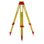
Leica GST103 Aluminum Telescopic Tripods for Dump Levels and Rotating Laser Levels Instruments Model: GST20-9 Specifications: Model GST20-9 Color Yellow Material Wooden Type Flat Head Tripods Closed Height ......
... Package 1pc/Carton Leica GST103 Aluminum Tripods Features: Light tripod with carrying straps and side clamp screws Suitable for levels, lasers and...
YR-SA adaptor used for ALS Al. levelling staff and prism set...
...survey accessories Features Leica 563624A HP PDA Cable 1. Model: 563624A 2. Connects Leica Total Station TM/TS30 to HP PDA Our Services We offer qualify superior pre-sale service to help you choose the right...
Product Description Sokkia IM-50 Series Total Station IM52 Dual Display Reflectorless 500m 2" accurancy Total Station: The IM-50 series offers the perfect entry-level site layout and survey instrument. The sle...
Galaxyz Brand DS101 Digital Automatic Level Instrument with Staff Detail Specification: World-Proven Precision and Durability MATO Digital Level DS101 with Staff Model DS101 Parameter Digital measuring Accuracy...