| Sign In | Join Free | My burrillandco.com |
|
... 10 km long range uav flying fpv video transmitter Offering control, telemetry & payload, Video Transmission Our wireless video transmission equipment are widely used in government surveillances, law enforce...
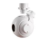
...UAV Gimbal Camera TS01T is three- axis gyro stabilized gimbal UAV gimblal camera, support 360° continuous rotation, Built-in 30X HD zoom visibla camera, the weightonly one kilogram, the servo stabilization s...
3-Lens Payload for M190 Drone With the 3-lens payload, during the day, the drone can perform daily patrols on cities and the coastline through 30x optical autozoom, 200W effective pixels , fast focusing, and hi...
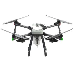
Description Hybrid Multi Purpose Agriculture UAV 22l Payload 6m Spray Width For Fertilizer And Granular Agriculture Sprayer 1.The ZAi-PC1W agricultural UAV, newly developed and independently researched by Unite...
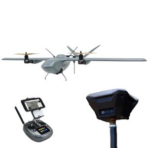
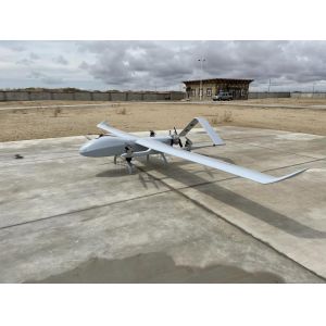
... uav mapping drone Long range aerial survey fixed wing uav mapping drone Material Carbon Fiber Function Public Safety Mapping Surveillance Color Customers' Demand Max payload 5kg Max takeoff weight 25kg Leve...
Product Specification span 4.6m Battery life 5-6h cruising speed 24m/s Maximum ceiling 5500m Takeoff and landing mode vertical takeoff and landing stall speed 15m/s Aircraft material Carbon fiber plus PVC posit...
TS130C-01 Three Axis Payload EO Infrared Thermal Imaging Laser Rangefinder Drone UAV Camera HD 1080p TS130C-01 is three- axis gyro stabilized gimbal platform, support 360 continuous rotation, Built in 30X HD z...
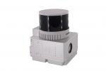
Uav Lidar Mapping Built-In 26MP RGB Camera Strong Penetration Power Line Forestry Surveying Geosun gAirHawk Sesries GS-130X LiDAR uav Scanning System UAV LiDAR Scanning System GS-130X integrates a Hesai XT32 la...
Smart City Application UAV LiDAR System Geosun GS-130X 3D Surveying And Mapping Hesai XT32 Sensor Applications Of uav LiDAR Scanning System Specification of uav LiDAR scanning system uav LiDAR scanning system g...
3D Tower Mapping Modeling UAV LiDAR Scanning System Geosun GS-130X Geosun gAirHawk Series GS-130X UAV LiDAR Scanning System UAV LiDAR Scanning System GS-130X integrates a Hesai XT32 laser sensor and all built-i...
Product Description: The UAV VTOL is a cutting-edge Commercial Drone UAV designed for professional aviation applications. Equipped with state-of-the-art technology, this UAV offers exceptional performance and v...
UAV Mapping Drone Nimbus Long Endurance VTOL UAV Drone with PPK for Precision Mapping and Survey Foxtech Nimbus VTOL V2 for Mapping and Survey(DA16 with PPK) Product Name Nimbus V2(X9D Combo) Stall Speed 10m/s ...
... for surveying, mapping, surveillance and inspection. At the same time, HXN1-B is a type of multi-rotor UAV. With its 90-minute battery life, centimeter-level positioning capabilities, IP66 rating, folding f...
... UAV for the application of long-range LiDAR . Its maximum load is 10kg, and the flight operation time can reach 120min when equipped with 6.5kg LiDAR. Combined with the design of independent detachable larg...
T16 hand held drone controller with Windows and Android systems (support tablets and mobile phones) T16 is a compact portable GCS that can safely control the drone and its payload. With Windows and Android syst...
Forestry 3D Mapping HESAI XT32 Senor UAV LiDAR GS-260X Colored Point Cloud Free Pre-Processing software High Accuracy UAV LiDAR Scanning System GS-260X integrates Hesai XT32 laser sensor and all built-in units ...
Fixed Wing Drone UAV LiDAR GS-130X HESAI XT32 3D Mapping Strong Penetration Geosun gAirHawk Sesries GS-130X uav LiDAR Scanning System LiDAR Scanning System GS-130X integrates a Hesai XT32 laser sensor and all b...
Terrain Mapping Aerial Surveying Geosun UAV LiDAR GS-130X High Precision Cost-Effective Cost Highly Integration Geosun gAirHawk Series GS-130X UAV LiDAR Scanning System Drone LiDAR Scanning System GS-130X integ...
...UAV VTOL (Vertical Take-Off and Landing) is an exceptional Unmanned Aerial Vehicle with Vertical Take-Off and Landing capabilities that is designed to meet the demands of various industries. With its innovat...